Sunday Creek Flood study

About the project

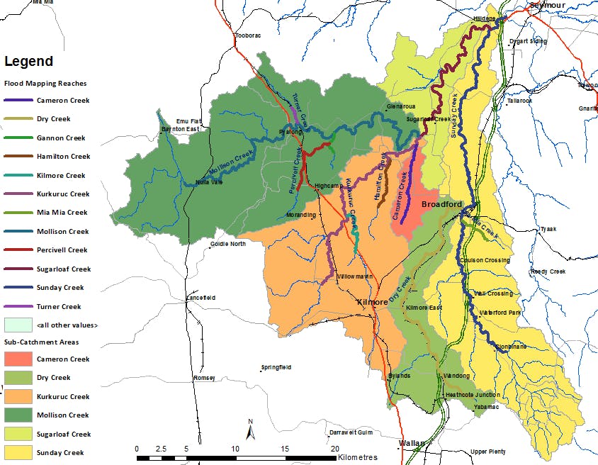
The Sunday Creek catchment is situated in the central Victorian district and covers approximately 980Km2; nearly a third of the Mitchell Shire Council land area.
This flood study, a collaborative effort by Mitchell Shire Council and the Goulburn Broken Catchment Management Authority (GBCMA), seeks to enhance our understanding of flood risks in the Sunday Creek community.

What's happened so far

In March 2019, we embarked on our initial round of community consultation. We invited residents to share photos, stories, and records, aiding in our comprehension of local flooding patterns. These contributions have been instrumental in refining our flood models and generating precise flood maps for our region.

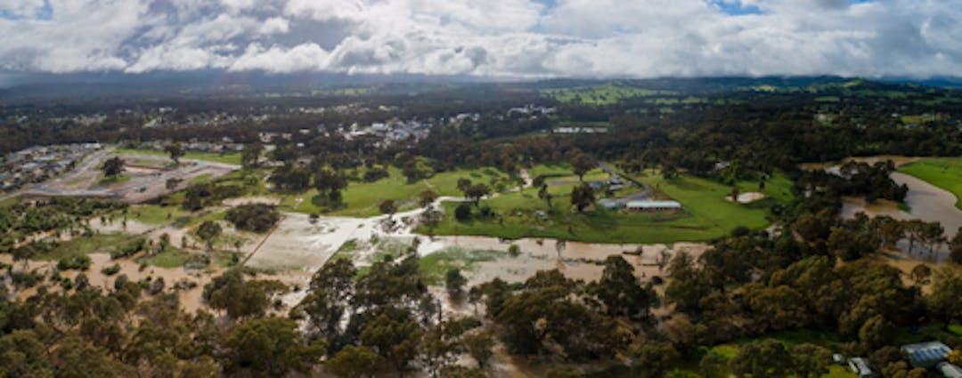
Following the 2019 consultations, we revised our study to incorporate these community insights. We also conducted simulations based on the significant flood event of 2022, enriching our models with contemporary scientific research and actual observations from the event.

View the Sunday Creek Flood Study interactive flood map

How you can get involved

We would like to share the study's findings with the community and welcome your feedback.

  • Online fill out a submission form
  • Talk to us in person about the findings of the report, or ask us any questions at one of our drop in sessions 17 & 20 April.
  • Pick up a copy of the submission form at one of our Customer and Library Service Centre
  • Write to us at Mitchell Shire Council, Reply Paid 70358, 113 High Street, Broadford, Vic, 3658 (no stamp required)

What happens next

The study's results will play a crucial role in shaping flood management strategies within the Mitchell Shire. This includes refining flood overlay controls for planning schemes, enhancing flood intelligence and emergency planning, and bolstering community awareness and education on flood risks. Additionally, the findings will support insurance risk assessments and aid the Goulburn Broken CMA in local flood risk analysis.

Closing date

Don't miss your chance to have your say before consultation closes at 9am on Thursday 9 May.


  • What area does the study cover?


    The Sunday Creek and Dry Creek catchments cover an area of about 970 square kilometres including:

    • Broadford
    • Clonbinane
    • Glenaroua
    • Heathcote Junction
    • High Camp
    • Hilldene
    • Kilmore
    • Kilmore East
    • Nulla Vale
    • Pyalong
    • Seymour
    • Sugarloaf Creek
    • Sunday Creek
    • Tallarook
    • Wandong
    • Waterford Park
    • Willowmavin


  • About the study

    Sunday Creek and Dry Creek Flood Study project is a part of the initiative under the Natural Disaster Resilience Grants Scheme with financial commitments by the Australian, state and local governments.

    This initiative will help build flood resilient communities. Improved knowledge of flood behaviour will also help with future land-use and development assessment by incorporating flood zone and overlay controls. It will also help inform the structure planning for Broadford and the rural valleys.

    The objective of this project is to produce flood maps for the Sunday Creek catchment, including Broadford and Heathcote Junction. These will outline the region's floodplains and will help council to better understand where flooding would occur during large rain events and how this has changed over time.

Page last updated: 22 Apr 2024, 09:01 AM