Sunday Creek Flood study
Consultation has concluded, we will report back with the outcome soon.
About the project
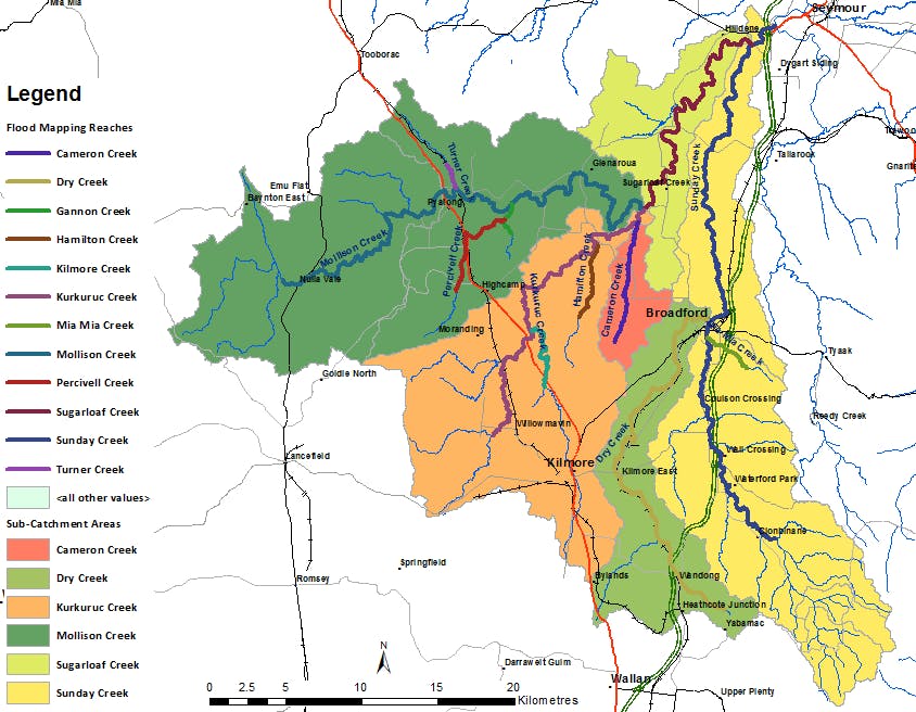
The Sunday Creek catchment is situated in the central Victorian district and covers approximately 980Km2; nearly a third of the Mitchell Shire Council land area.
This flood study, a collaborative effort by Mitchell Shire Council and the Goulburn Broken Catchment Management Authority (GBCMA), seeks to enhance our understanding of flood risks in the Sunday Creek community.
What's happened so far
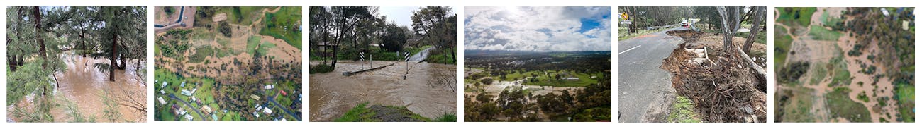
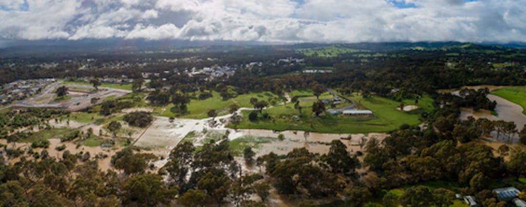
In March 2019, we embarked on our initial round of community consultation. We invited residents to share photos, stories, and records, aiding in our comprehension of local flooding patterns. These contributions have been instrumental in refining our flood models and generating precise flood maps for our region.
Following the 2019 consultations, we revised our study to incorporate these community insights. We also conducted simulations based on the significant flood event of 2022, enriching our models with contemporary scientific research and actual observations from the event.
View the Sunday Creek Flood Study interactive flood map
How you can get involved
We would like to share the study's findings with the community and welcome your feedback.
- Online fill out a submission form
- Pick up a copy of the submission form at one of our Customer and Library Service Centre
- Write to us at Mitchell Shire Council, Reply Paid 70358, 113 High Street, Broadford, Vic, 3658 (no stamp required)
- Talk to us if you have further questions call Council 03 5734 6200
What happens next
The study's results will play a crucial role in shaping flood management strategies within the Mitchell Shire. This includes refining flood overlay controls for planning schemes, enhancing flood intelligence and emergency planning, and bolstering community awareness and education on flood risks. Additionally, the findings will support insurance risk assessments and aid the Goulburn Broken CMA in local flood risk analysis.
Closing date
Don't miss your chance to have your say before consultation closes at 9am, Monday 10 June .