Seymour Whiteheads Creek Flood Study
Consultation has concluded
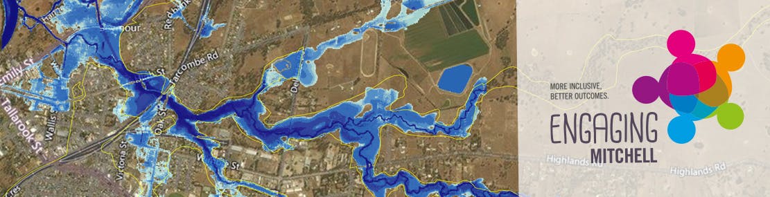
Over the last eighteen months, Mitchell Shire Council, supported by the Goulburn Broken Catchment Management Authority (GBCMA), has been working on the Whiteheads Creek Flood Mapping and Intelligence Study.
We've received some new flood maps that show the impact from Whiteheads Creek in the 1973 flood, some modelling for a 1-in-100 year flood from Whiteheads Creek and some modelling to show what impact a levee along the Goulburn River may have on the Whiteheads flood area.
We now need your input to help review the mapping based on your understanding of historic flooding events of the Whiteheads Creek and its tributaries in and around the Seymour township.
We're also keen to talk to anyone in the area about the changes that a levee might bring.
You can attend a drop-in session (see below) or share your flood photos online.