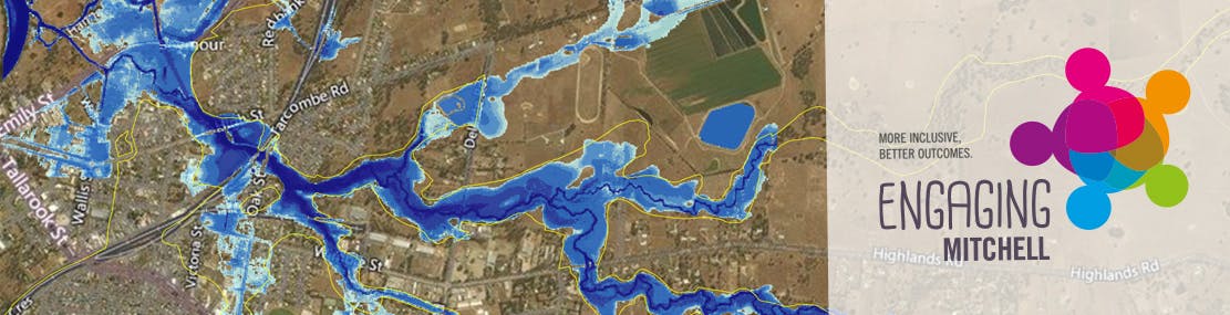
About the maps
The following draft flood maps are available on the website:
- 1 in 100 year (1% AEP) flood of Whiteheads Creek (without levee)
- 1 in 100 year (1% AEP) flood of Whiteheads Creek (with levee)
- 1 in 100 year (1%AEP) change in flood level due to levee
- 1973 event (without levee)
The flood maps show a draft version of the expected peak flood extent and depth for the relevant event.
A 1% Annual Exceedance Probability flood event is a flood event that has a 1% chance of occurring in any given year.
Share About the maps on Facebook
Share About the maps on X (formerly Twitter)
Share About the maps on Linkedin
Email About the maps link
Consultation has concluded
