About the project

In conjunction with the Kilmore Structure Plan) and supported by the Goulburn Broken Catchment Management Authority, Council has been working on the Kilmore Flood Mapping and Intelligence Study. With the completion of draft flood mapping it is now time for local residents to provide their input.
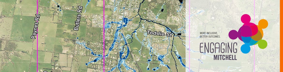
Given that Kilmore has not flooded in recent years there is limited information available to confirm the accuracy of the draft mapping. It would be great if local residents could share their local knowledge of flooding behaviour and issues around the area. It is important that the final flood mapping produced for this study is as accurate as possible as it will be used as a basis for planning, development, future flood mitigation works and emergency management purposes.
The flood maps shown on this website show a draft version of the expected peak flood extent and depth of a 1% Annual Exceedance Probability flood event. That is a flood event of this magnitude or larger has a 1% chance of occurring in any given year.
To allow you to have your say, two information sessions are planned for Thursday 23 February 2017 at the Kilmore Library with Mitchel Shire Council and the consultants producing the mapping. It would be great if you could share your knowledge with us at these sessions.
Session 1: 2 – 4 pm Thursday 23 February 2017 – John Taylor Room - Kilmore Library, Kilmore.
Session 2: 6 - 8pm Thursday 23 February 2017 – John Taylor Room – Kilmore Library, Kilmore.
For more information please contact Cameron Baird on 5734 6200 or email cameron.baird@mitchellshire.vic.gov.au
Consultation has concluded
