FAQ
What sort of input can I provide?
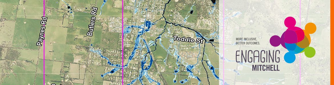
We would like you to look over the draft flood maps and provide information, photos or videos about what you've seen in the area during different flood events.
We'll also provide an update on the project.
Why do you need input now?
Given that Kilmore has not had a major flood in recent years, there is limited information available to confirm the accuracy of the draft mapping.
We need you to share your local knowledge of flooding behaviour and issues around the area.
It is important that the final flood mapping produced for this study is as accurate as possible as it will be used as a basis for planning, development, future flood mitigation works and emergency management purposes.
What will the information sessions cover?
to update the community on the current draft mapping outcomes and seek any historic flood information to help verify and improve the mapping prior to finalisation.
We want to tap into local knowledge. Your input will help inform future planning, development, emergency management and possible flood mitigation works for the township.
I can't make it to the information session, how else can I share my information or find out more?
There are a number of other ways you can get involved.
- Provide a comment using our places tool on this site
- Send an email to cameron.baird@mitchellshire.vic.gov.au (please keep file size of any photos under 2MB if possible)
- Phone Council on 5734 6200
What will happen after the information sessions?
Information from the sessions will be fed back into the study to further refine the model and its findings for future consideration in a planning scheme amendment process (note: any planning scheme changes would be subject to a separate consultation process).